Why Rivers Keep Reappearing as Regional Edges
Why rivers keep reappearing as regional edges becomes clearer when you trace how channels, valleys, crossings, and settlements shape a place’s identity.
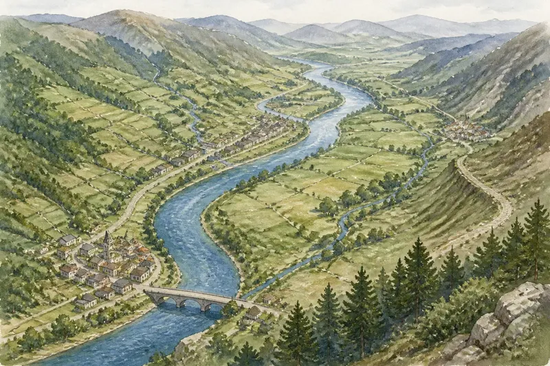
On a regional map, a river can frame a valley, mark a change in landscape, or give nearby towns a shared point of reference. Why rivers keep reappearing as regional edges has less to do with a simple line on the map than with how the watercourse shapes the places around it.
How does a river shape a region’s landscape?
A river gathers smaller streams, cuts through terrain, and creates a corridor that can differ from the uplands on either side. Its valley may have distinct soils, vegetation, floodplains, or patterns of settlement. Those physical features can make the river system a useful way to describe a region without treating the channel as a dividing line.
Look beyond the water itself. A regional description may include the valley floor, tributaries, nearby slopes, and the settlements that depend on the same local landscape. A drainage basin can be useful for describing land and water, but it may not match the area people identify as their region.
Which features help define a river region?
Choose features that support the specific regional description. A map focused on landforms might emphasize the valley and surrounding ridges. One concerned with settlement might show towns and roads that follow the river corridor. A place-name map could highlight names that refer to the river, its tributaries, or local valley features.
- Valley form: If a continuous valley is visible on a terrain map, include the valley corridor; if steep slopes break it into distinct sections, map those sections separately.
- Tributaries: If several tributaries feed the same main channel within the area, show them as part of the river system; if a tributary leads into a different landscape or settlement cluster, distinguish it.
- Settlement pattern: If towns cluster along the same stretch, include them as a corridor; if a town faces a separate road or service center, avoid assuming it belongs to the river region.
- Local names: If a shared river or valley name appears in local place names, note that connection; if names differ across the area, preserve those distinctions rather than assigning one label to all.
- Crossings and roads: If bridges or roads link nearby settlements along the corridor, show those links; if the route turns toward another center, map that connection separately.
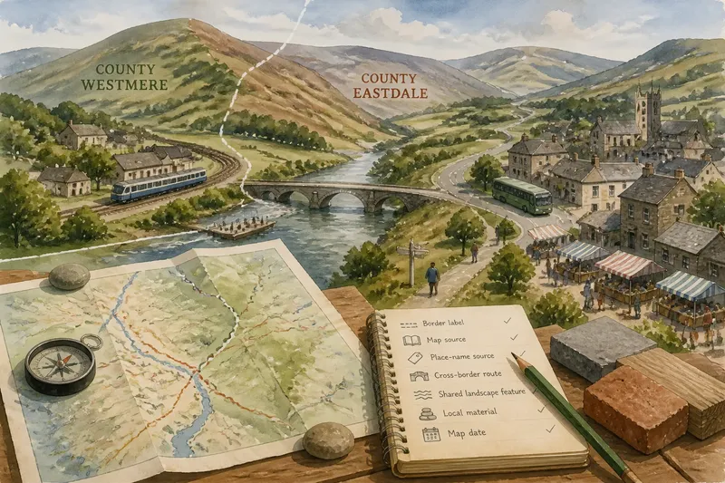
- Landscape changes: If vegetation, slope, or land use changes clearly along the course, mark the transition; if the landscape remains similar, do not invent a boundary at the channel.
How do settlements give a river corridor its character?
Towns often grow where the valley offers a route, water, flatter ground, or a crossing point. Their shared setting can create a recognizable regional pattern, but proximity to the same river is only a starting clue. Check which roads residents use, where services are located, and whether settlements relate to the same stretch of the valley.
Imagine a fictional map with three towns beside one river. The first two lie along a continuous valley and share a road that follows the water; the third sits where the river bends toward a different upland road. Mark the first pair as a connected corridor, then show the third town’s upland link separately. The resulting map presents a coherent valley grouping without suggesting that all three towns have identical ties.
What should a map say about a river region?
State the rule behind the outline in plain language. For example, a map may define its area as “the continuous valley settlements and their immediate tributary corridors.” That wording tells readers what is included and makes clear that the outline describes a chosen geographic pattern, not an automatic regional division.
Use symbols that distinguish terrain from settlement and travel. A shaded band can show the valley floor, thin lines can show tributaries, and small markers can identify towns. Include a legend, and name the map source where the boundary or geographic feature comes from. If the outline relies on local identity rather than visible terrain, say what evidence informed that interpretation.
What do readers ask about river regions?
Does a river basin define one region?
Not necessarily. A basin describes land that drains toward a river system, while a cultural or settlement region may follow different limits. Use the basin when water flow is the subject, and explain any different rule used for a regional outline.
Should a river region include its tributaries?
Include tributaries when they contribute to the landform or settlement pattern you are describing. If a tributary corridor has a separate identity or connection, show it as a distinct subregion instead of folding it into one undifferentiated area.
Can towns belong to a river region without sitting on the bank?
Yes. A town may be linked to the valley by a road, service network, or nearby tributary. Show the actual connection rather than relying on distance from the channel alone.
How can place names reveal a river’s regional role?
Names that refer to a river, valley, or tributary can indicate which landscape features people use as local reference points. Treat names as clues, then keep distinct local names visible where they mark different parts of the region.
How can you choose a useful river-region outline?
Start with the map’s subject, then compare the river’s valley, tributaries, settlements, roads, and local names against that purpose. If the features form a continuous pattern, draw an outline that follows it. If they point in different directions, show separate layers or sections instead of forcing them into a single shape.
Why rivers keep reappearing as regional edges is that a river system often organizes both the land and the ways people describe it. A carefully named outline can show which parts of that system matter—and where the landscape or local connections shift along the course.